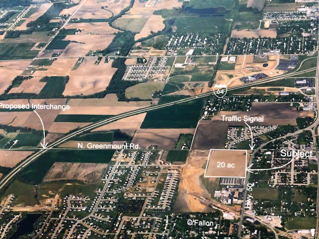
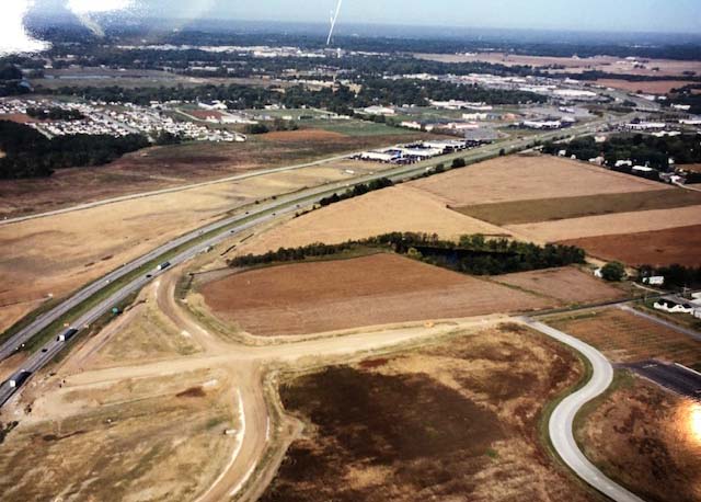
That’s right. There was a time, not so very long ago, before Google Earth or drones were even a thing. So, in the Commercial Real Estate (CRE) world, that meant finding other means for getting aerial imagery to better present Land for sale, development, or otherwise.
Aerial photography prior to drones was mostly done by means of someone flying in an aircraft and taking pictures. Hiring an aerial photographer was one way to do this.
Another way would be to hire a helicopter service and take the photos yourself (Terry Johnson).
Paper map. Hand-written pin-points and notes.
Duct tape wrapped securely around the lever of the seat belt latch.
Arrive at point of reference.
Ask pilot to adjust for perspective, if needed.
Open door for a nice clean view.
Click.
Then you go get your film developed into 8″ x 10″ prints and hope you captured what you were aiming for.
And voila.
There is another whole layer to the processing for marketing, but that’s for another story.
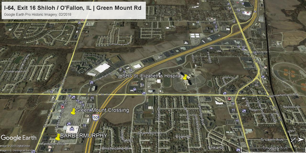
And in case you are interested, here is the area via Google Earth Pro Historic Imagery, then and now:

Aerial ImagesHelicopter Aerial PhotographyI-64 Exit 16 ILMetro EastO'FallonO'Fallon/Shiloh I-64 CorridorShilohSt. Louis MSA